
USDA’s Conservation Effects Assessment Project (CEAP) collaborates with partners to deliver tools that support conservation assessment and planning for diverse land uses and management goals.
CEAP Supports Tools for Conservation
CEAP is a multi-agency effort led by USDA’s Natural Resources Conservation Service (NRCS) to quantify and report on trends in conservation across the nation’s private agricultural, forested, and grazing lands. CEAP findings support conservationists, agricultural producers, and partners in making informed management decisions backed by data and science.
Through CEAP, USDA collaborates with partners from federal and state agencies, universities, and non-government organizations to deliver tools that support conservation assessment and planning across a range of landscapes and for a diversity of management goals. Below are details on four tools developed with CEAP support. Please reference this page frequently for access to new tools that may be released and updates on existing resources.
Access Available Tools
Click the links below to access unique tools that may strengthen conservation assessment and planning efforts for your geographic area, land use, and management goals of interest.
Please note, these tools represent only a portion of the resources available to support NRCS customers and are not intended to replace on-the-ground knowledge or direct conservation planning assistance available via the agency. While NRCS supported the development of these tools, they are officially hosted and managed by external partner organizations. Contact the NRCS office at your local USDA Service Center to learn more about conservation assistance and resources available directly through NRCS.
Agricultural Conservation Planning Framework
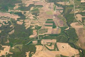
The Agricultural Conservation Planning Framework (ACPF) is a web-based resource that supports targeted, strategic conservation planning at the small watershed scale. ACPF was developed by USDA’s Agricultural Resource Service in collaboration with NRCS.
ACPF consists of a framework of conservation priorities that may improve watershed health, databases for select hydrologic unit code (HUC)-12 watersheds across the upper Midwest, and a toolbox for use in ArcGIS. Users, including conservationists and other planners, may leverage this resource to identify high-risk areas for targeted conservation and to generate suites of site-specific conservation opportunities and associated output maps to inform future conservation efforts. ACPF data are currently available for Illinois, Iowa, Minnesota, and Wisconsin and parts of Indiana, Kansas, Missouri, Nebraska, North Dakota, and South Dakota.
Visit the ACPF website to learn more and directly access this resource with supporting materials.
Predictor of Avian Communities Tool
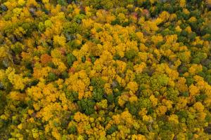
The Predictor of Avian Communities Tool (PACT) is a web-based tool that allows users to assess the potential effects of forest composition and management decisions on select bird communities. PACT was funded by the National Fish and Wildlife Foundation and NRCS, with additional support provided by the U.S. Forest Service and University of Massachusetts.
Users including conservationists, forest landowners and other land managers, and researchers may use PACT to assess the effects of openings in forests – including their size, proximity to other openings, and residual basal area – on mature forest and shrubland bird species. Project-specific outputs include the total number of species expected given a particular management scenario and the likelihood of individual species occurrence. Users may leverage this tool to consider the effects of various silvicultural treatments and associated predicted changes to bird communities in a user-specified area. PACT is intended for use in the temperate forests of the eastern United States and Canada.
Visit the PACT website to learn more and directly access this resource with supporting materials.
Rangeland Analysis Platform
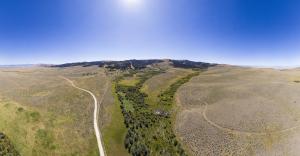
The Rangeland Analysis Platform (RAP) is an online application that provides users direct access to geospatial vegetation data for rangeland in the United States. RAP was developed by the University of Montana in partnership with NRCS, USDA’s Agricultural Research Service, and the Bureau of Land Management.
RAP enables users including conservationists, ranchers and other land managers, resource managers, and researchers to visualize and analyze continuous vegetative cover, annual aboveground biomass, and 16-day aboveground biomass for specific locations and across geographic scales. Associated tools include a Production Explorer and Stocking Rate Calculator Tool. RAP is intended to support users in monitoring rangeland and evaluating current or past management strategies to ultimately strengthen land management planning.
Visit the RAP website to learn more and directly access this resource with supporting materials.
Vegetation GIS Data System
The Vegetation GIS Data System (VGS) provides a suite of software applications that allow users to record, manage, analyze, and report on natural resources data across multiple land types including rangeland, cropland, and forests. VGS was developed by the University of Arizona in partnership with USDA’s Forest Service and NRCS, the Bureau of Land Management, the National Park Service, and the Public Lands Council.
Users including field data collectors, data managers, and researchers may use VGS to collect and assess a range of vegetation-related metrics, including those affecting rangeland health and pasture conditions. VGS manages both qualitative and quantitative inputs, photos, geocoordinates, and support documents and performs background calculations to instantly display results. This resource leverages the entire NRCS Plants Database, and users may create their own unique species lists for locations of interest across the United States. VGS includes pre-loaded standard field protocols supported by NRCS, USDA’s Agricultural Research Service and U.S. Forest Service, and others.
Visit the VGS website to learn more and directly access this resource with supporting materials.
Additional Resources
Conservation Effects Assessment Project (CEAP)
USDA’s Conservation Effects Assessment Project (CEAP) is a multi-agency effort led by the Natural Resources Conservation Service (NRCS) to quantify the effects of conservation practices across the nation’s working lands.
Learn MoreFrequently Asked Questions | Conservation Effects Assessment Project
This webpage provides answers to frequently asked questions about the Conservation Effects Assessment Project (CEAP).
Last Updated: June 9, 2023
Learn MorePublications | Conservation Effects Assessment Project
USDA’s Conservation Effects Assessment Project, CEAP, provides a suite of publications highlighting the effects of voluntary conservation across the nation’s working lands.
Learn MoreConservation Outcomes Webinar Series
The Conservation Outcomes Webinar Series provides key findings, data, and tools to support producers and partners in pursuing voluntary conservation efforts across the nation's working lands.
Learn More