Concrete, Equipment, and Long Wet Days
The NRCS Montana snow survey team ventured out near Onley, Montana in the Stillwater State Forest to the Stryker Basin snow course to install a Snow Telemetry (SNOTEL) site. Learn why our snow survey team is doing this and how it benefits you!
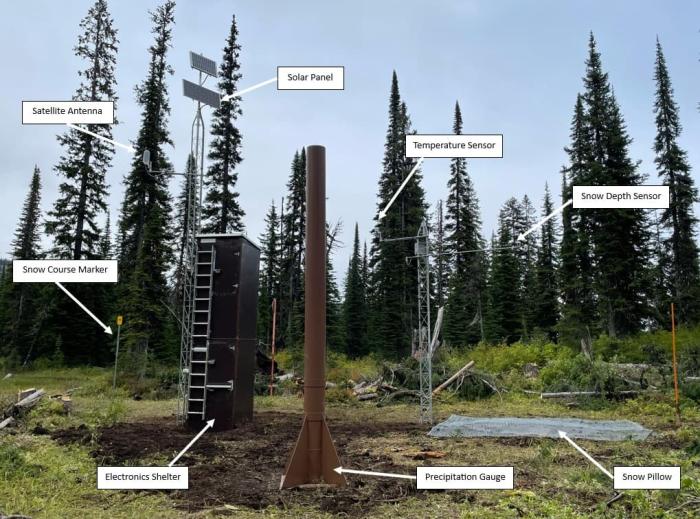
SNOW COURSE TO SNOTEL SITE
At the end of August, The NRCS Montana snow survey team worked with the Stillwater State Forest staff to do site preparation for a three-day SNOTEL site install endeavor. “The state forest was a big part of getting this permitted and getting all those snow measurements for us over the years, “said Eric Larson, NRCS Water Supply Specialist. A major benefit of replacing a snow course with a SNOTEL site is, eventually after 10 years of concurrent measurements, the manual snow course measurements will no longer be needed.
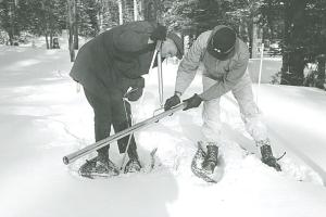
Originally a snow course from 1977, Stryker Basin was ready for an update. The idea is to automate the snow survey site so that it can replace the need to do manual measurements, which is time consuming and can be strenuous to access the remote locations. Currently, manual snowpack measurements are taken at Stryker Basin from February to June, around the first of each month, with 10 measurements being extracted each time. In addition to the snow water equivalent and snow depth, which is collected at the snow course, the SNOTEL site collects and transmits air temperature and precipitation data on an hourly basis.
INSTALL AND RAIN FALL
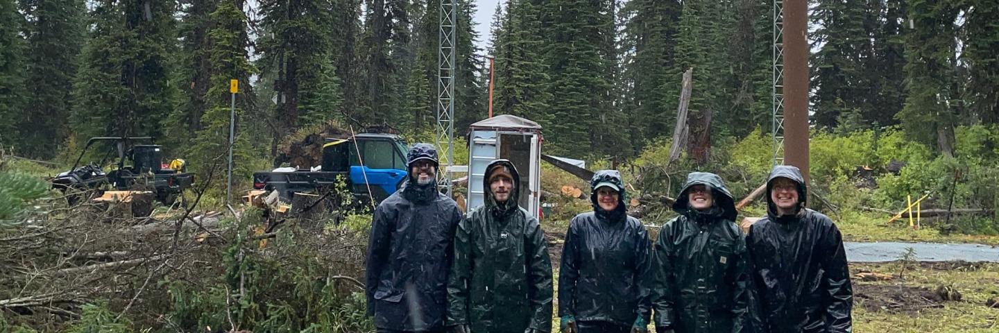
The crew consisted of Eric Larson, Colin Kultys, Mage Hultstrand, Lexi Landers, and Lauren Austin who hit the ground running, working 12-hour days at the site. Even though that area of Montana had been dry, and, in a drought, the week of the installment was not. “It rained over two inches and temperatures were in the mid-40s on our second day,” Larson remarked with a slight laugh. The weather was relentless, but the snow survey team persevered and spent the three days working together to complete the installation.
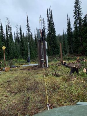
“It's a lot of equipment to haul in and requires a lot of concrete,” Larson stated. It took about 32 bags of concrete and an array of equipment to install a shelter, snow pillow, two towers, and a precipitation gauge. The spot where they were installing and building at was 300 yards away from a usable road, “From there we used two side by sides to shuttle in all of the equipment,” Larson said. Even with the challenging weather, hauling equipment, concrete pours, and a short-time frame, the crew accomplished what they went out there to do, to fully install a new SNOTEL site.
SNOW SURVEY PROGRAM
Larson explained, “Water is utilized for everything from agriculture, municipal use, and hydroelectric power in the western United States. The snow survey program plays a vital role in providing water supply forecasts for water users across the western United States.” By collecting the snowpack data at snow courses and using the SNOTEL network, the snow survey program makes mountain snowpack and precipitation data available to the public along with snowmelt-driven runoff predictions for the spring and summer.
For more information on the snow survey program and products and reports, go to Montana Snow Survey Webpage. You can also sign up to receive notifications when Montana’s monthly Water Supply Outlook Reports are released from January through June.