
Expanding Soils Monitoring in Oregon to enhance drought assessments and compliment modeling related to evaporative demand, streamflow, and surface runoff. Soil monitoring was established at 3 existing SNOTEL sites in 2023.
Background
The current soil monitoring network across Oregon is inadequate and lacks finer spatial resolution for soils data, critical for drought assessment and supplementing water supply forecasting. The Oregon Snow Survey established the Oregon Soil Monitoring Initiative (OSMI) in early 2023 with a mission to expanding soils monitoring in Oregon by leveraging the SNOTEL and SNOLITE site networks. OSMI is spearheaded by the NRCS Oregon Snow Survey, in coordination with Oregon Climate Services and Oregon Water Resource Department, and field expertise from the NRCS Soil Survey.
OSMI is currently a 3-year initiative to replace current defunct sensors and install new sensors at sites in areas where soils data would be of high value, including areas with significant agriculture downstream and areas that tend to be impacted by longer-term drought, yet lack sufficient data for more robust drought assessment. In addition to installing new sensors at current sites, all new SNOTEL and SNOLITE sites will include soil probes as the standard suite of monitoring equipment.
2023 Installations
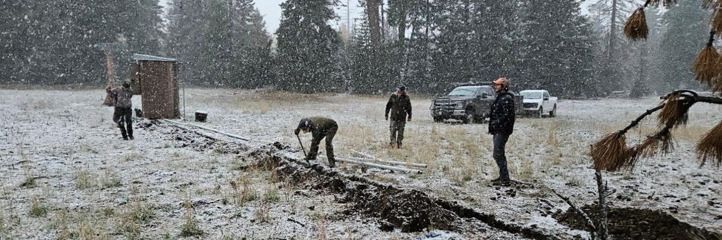
In 2023, soil probes were installed at 3 existing SNOTEL sites: Derr. and Ochoco SNOTELs in the Ochoco National Forest and Roaring River SNOTEL in the Willamette National Forest. These installations were conducted by both staff from the Portland Data Collection Office and the Redmond MLRA (Major Land Resource Area) Soil Survey Office.
The installs, permitted by the Forest Service, included excavation of a soil pit within 80 feet of the site shelter, soil description, soil sampling, and installation of probes. These probes were installed at depths of 2”, 4”, 8”, 20” and 40” from the surface of the top-soil layer. Parameters measured are dielectric permittivity, volumetric soil moisture, electrical conductivity, and soil temperature. Data is available hourly in data reports accessed via the Interactive Map available on the Oregon Snow Survey and National Water and Climate Center websites.