
Fire Adapted Bitterroot is a Joint Chiefs' Landscape Restoration Partnership project that address forest health and wildfire risk in three main areas of Ravalli County in western Montana.
On This Page
Project Description
Project duration: 2022-2024
Project area: Portions of Ravalli County, Montana

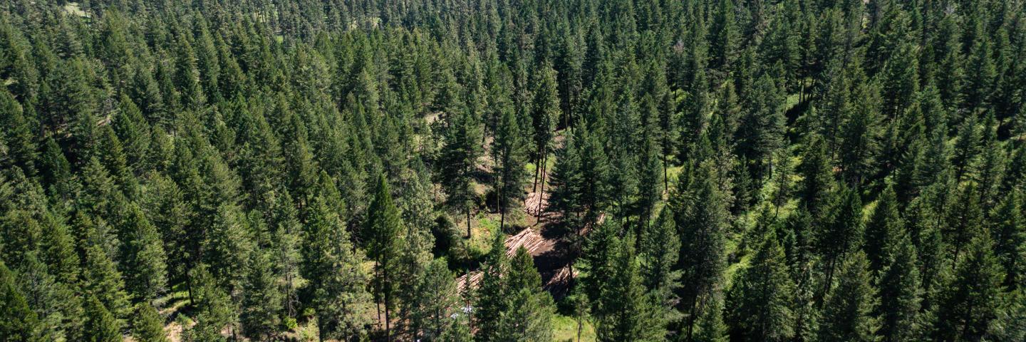
Fire Adapted Bitterroot (FAB) seeks to address forest health and wildfire risk in three main areas of Ravalli County in Western Montana. This proposal will actively treat fuels on 1,350 acres on the east side of the valley in year 1 (2022), 3,250 acres in the southern valley in year 2 (2023), and 4,000 acres on the west side of the main valley in year 3 (2024). The desired outcome is to increase forest health and landscape resiliency, provide for public and firefighter safety, reduce fire risk to communities, improve wildlife habitat, contribute to community viability with forest products and jobs, and increase recreation opportunities - all while restoring fire to our fire dependent ecosystems. This proposal focuses on lower elevation fire adapted forest systems that are comprised of primarily overstocked ponderosa pine with Douglas-fire encroachments that have missed one or more fire return interval. The Bitterroot Valley has 300,920 priority area acres identified by the Montana Forest Action Plan and 5 of the top 10 Firesheds facing the most wildfire risk in Montana. (See Map 1 - Fire Adapted Bitterroot Fire Risk) This threat - combined with unprecedented growth and new home construction that extends to the boundary of the Bitterroot National Forest (BNF) - highlights why we need action across all ownerships. Proposed fuel reduction treatments (USFS + NRCS = 10,130 acres over 3 years), while not wall to wall, will address fuel loading and fire risk and take another critical step to increasing fire's role on the landscape. The project will also increase the success of future wildfire suppression operations to protect critical infrastructure that occur in or adjacent to these treated landscapes.
Project Partners
The USDA Natural Resources Conservation Service and the U.S. Forest Service as well as other Federal, state, county, and local entities:
- Ravalli County Collaborative
- Montana Department of Natural Resources and Conservation (DNRC)
- Montana Fish, Wildlife & Parks
- Confederated Salish & Kootenai Tribes (CSKT)
- Bitterroot Conservation District
- Rocky Mountain Elk Foundation
- Montana Wild Sheep Foundation
- Ravalli Resource Advisory Committee
Applicable Conservation Practices
- 106 Forest Management Plan
- 165 Forest Management Design and Implementation Activity
- 315 Herbaceous Weed Treatment
- 342 Critical Area Planting
- 383 Fuel Break
- 384 Woody Residue Treatment
- 666 Forest Stand Improvement
Detailed descriptions of these conservation practices can be found in the Field Office Technical Guide, Section 4 - Practice Standards and Supporting Documents.
When to Apply
Program applications are accepted on a continual basis. However, NRCS establishes application ranking dates for evaluation, ranking and approval of eligible applications. Applications received after the ranking date will be automatically deferred to the next funding period. See Montana Programs and Application Dates.
Local Ranking Questions
NRCS uses these questions to evaluate eligible applications for this project and to prioritize applications for potential funding.
- Does the EQIP contract leverage the management of natural resources across land ownership (public-private) boundaries?
- EQIP project is located in an area that is adjacent to high priority projects on public land as identified in the selected Joint Chiefs’ Landscape Restoration Project proposal.
- EQIP project is located in an area that is within the same 12-digit hydrologic unit as high priority projects on public land as identified in the selected Joint Chiefs’ Landscape Restoration Project proposal.
- Are planned practices located within the following proximity to previously completed or planned forest thinning/fuel reduction projects?
- Directly adjacent
- Located within half mile
- Does the project include forestry treatments that will address insect or disease issues within the stand?
- Yes
- No
- Does the project include forestry treatments that will be implemented within priority areas as identified by the Montana Forest Action Plan?
- Yes
- No
Contact
Hamilton Service Center in Ravalli County, Montana
Additional Montana Information
NRCS contributions to Joint Chiefs' Landscape Restoration Partnership projects in Montana are managed through the Montana Environmental Quality Incentives Program (EQIP).
Ready to get started?
Contact your local service center to start your application.
How to Get Assistance
Do you farm or ranch and want to make improvements to the land that you own or lease?
Natural Resources Conservation Service offers technical and financial assistance to help farmers, ranchers and forest landowners.
To get started with NRCS, we recommend you stop by your local NRCS field office. We’ll discuss your vision for your land.
NRCS provides landowners with free technical assistance, or advice, for their land. Common technical assistance includes: resource assessment, practice design and resource monitoring. Your conservation planner will help you determine if financial assistance is right for you.
We’ll walk you through the application process. To get started on applying for financial assistance, we’ll work with you:
- To fill out an AD 1026, which ensures a conservation plan is in place before lands with highly erodible soils are farmed. It also ensures that identified wetland areas are protected.
- To meet other eligibility certifications.
Once complete, we’ll work with you on the application, or CPA 1200.
Applications for most programs are accepted on a continuous basis, but they’re considered for funding in different ranking periods. Be sure to ask your local NRCS district conservationist about the deadline for the ranking period to ensure you turn in your application in time.
As part of the application process, we’ll check to see if you are eligible. To do this, you’ll need to bring:
- An official tax ID (Social Security number or an employer ID)
- A property deed or lease agreement to show you have control of the property; and
- A farm number.
If you don’t have a farm number, you can get one from USDA’s Farm Service Agency. Typically, the local FSA office is located in the same building as the local NRCS office. You only need a farm number if you’re interested in financial assistance.
NRCS will take a look at the applications and rank them according to local resource concerns, the amount of conservation benefits the work will provide and the needs of applicants. View Application Ranking Dates by State.
If you’re selected, you can choose whether to sign the contract for the work to be done.
Once you sign the contract, you’ll be provided standards and specifications for completing the practice or practices, and then you will have a specified amount of time to implement. Once the work is implemented and inspected, you’ll be paid the rate of compensation for the work if it meets NRCS standards and specifications.