
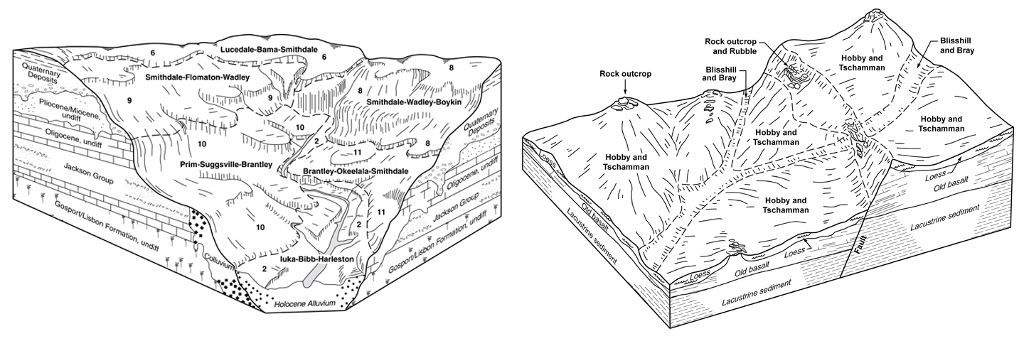
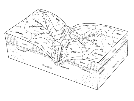
Locator map and list of block diagrams from published soil surveys.
More than 3,700 block diagrams (line drawings) from published soil surveys are available. Most of the diagrams relate soils to landscape positions. You may search for diagrams in two ways: a comprehensive spreadsheet or an interactive map. The comprehensive spreadsheet is linked to the diagrams in PNG format. Users can search the spreadsheet for specific key words, such as a series name or a county. The interactive map shows the location of survey areas for which a diagram is available.
Additional Information
Soil Surveys by State
Historical soil surveys have been scanned, converted to portable document format (pdf), and archived on a public download site.
Learn MoreContact Soils
Please contact us if you see something that needs to be updated, if you have any questions, or if you need accessibility assistance.