
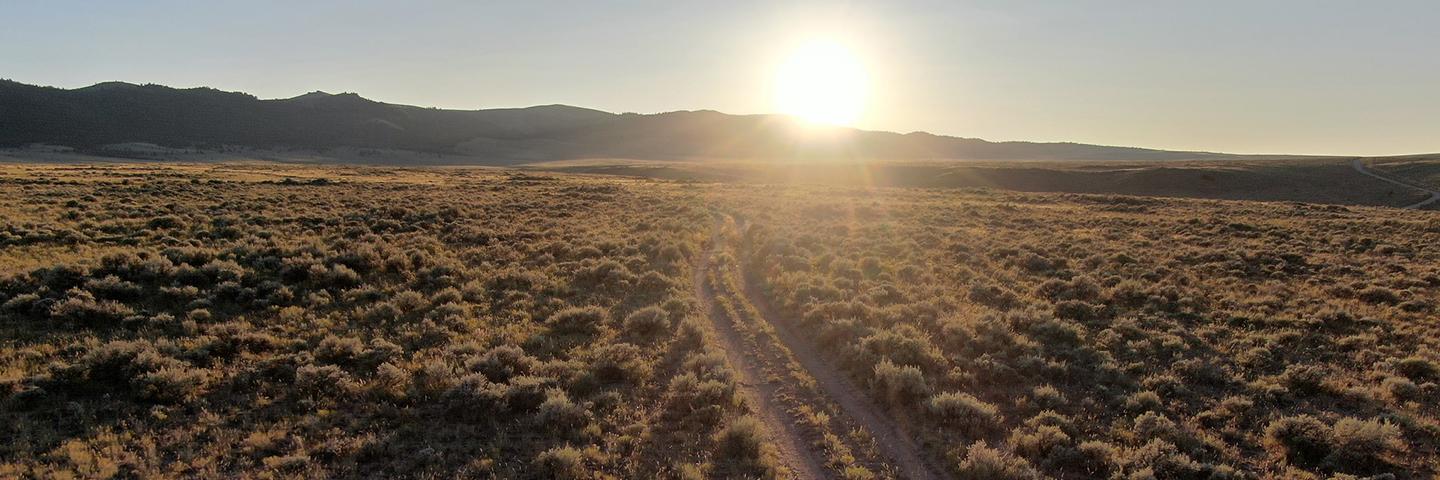
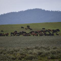
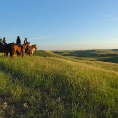
Conservation Effects Assessment Project (CEAP) grazing land assessments quantify the effects of voluntary conservation efforts across the nation’s non-federal grazing land, including private pastureland and rangeland.
About CEAP Grazing Land Assessments
Grazing land is a collective term for rangeland, pastureland, grazed forestland, native and naturalized pasture, hayland, and grazed cropland. Through CEAP, the Natural Resources Conservation Service (NRCS) quantifies trends in voluntary conservation practices across the nation’s private grazing land.
CEAP assessments inform management decisions for a diversity of land managers and partners by highlighting the effects of conservation practices – and identifying where they are needed – with respect to factors such as plant productivity, soil erosion, and water quality. CEAP also provides tools, interpreted data layers, and other products for conservation planners, ranchers, and partners to use when considering the best solutions for healthy, productive grazing land. Details on the methods for CEAP grazing land assessments are available on the CEAP Frequently Asked Questions page.
CEAP Grazing Land Publications and Relevant Tools
Bibliographies, Articles, and Reports
The below publications provide data and associated insights on the effects of voluntary conservation across the nation's grazing land. Categories include bibliographies and articles and reports. Publications within each category are organized in descending order by date.
Bibliographies
- Conservation Outcomes for Pastureland and Hayland Practices: Assessment, Recommendations, and Knowledge Gaps, 2012 (40.9 MB)
- Conservation Benefits of Rangeland Practices: Assessment, Recommendations, and Knowledge Gaps, 2011 (25 MB)
Articles and Reports
Range
- Ranch-Level Economics of Lesser Prairie Chicken Conservation Practice, 2025, Rangeland Ecology and Management
- Developing a valuation framework for rangeland conservation investments and ecosystem services, 2025, Journal of Soil and Water Conservation
- Quantifying Regional Ecological Dynamics Using Agency Monitoring Data, Ecological Site Descriptions, and Ecological Site Groups, 2025, Rangeland Ecology & Management
- Automated Identification of Earthen Berms in Western US Rangelands from LiDAR-based Digital Elevation Models, 2024, Earth Surface Processes and Landforms
- Snow simulation for the rangeland hydrology and erosion model, 2024, Journal of Hydrology
- Insights from the USDA Grazing Land National Resources Inventory and field studies, 2024, Journal of Soil and Water Conservation
- Accounting for Nature’s Value with Rangeland Conservation Practices in the Western Range and Irrigated Region, 2024, Earth Economics
- Establishing quantitative benchmarks for soil erosion and ecological monitoring, assessment, and management, 2024, Ecological Indicators
- An artificial neural network to estimate the foliar and ground cover input variables of the Rangeland Hydrology and Erosion Model, 2024, Journal of Hydrology
- Automated Earthwork Detection Using Topological Persistence, 2024, Water Resources Research
- Rangeland Brush Estimation Tool (RaBET): An Operational Remote Sensing-Based Application for Quantifying Woody Cover on Western Rangelands, 2023, Remote Sensing
- The Landscape Data Commons: A system for standardizing, accessing, and applying large environmental datasets for agroecosystem research and management, 2023, Agricultural & Environmental Letters
- An artificial neural network emulator of the rangeland hydrology and erosion model, 2023, International Soil and Water Conservation Research
- Financial barriers and opportunities for conservation adoption on US rangelands: A region-wide, ranch-level economic assessment of NRCS-sponsored Greater Sage-grouse habitat conservation programs, 2023, Journal of Environmental Management
- A framework and toolset for standardizing agroecosystem indicators - ScienceDirect (2022) Ecological Indicators
- Multi-Temporal LiDAR and Hyperspectral Data Fusion for Classification of Semi-Arid Woody Cover Species, 2022, Remote Sensing
- Ten practical questions to improve data quality, 2022, ScienceDirect
- Parameterizing an aeolian erosion model for rangelands, 2022, ScienceDirect,
- Wind Erosion in Anthropogenic Environments, 2022, ScienceDirect, Treatise on Geomorphology (2nd Edition)
- Vegetation Canopy Gap Size and Height: Critical Indicators for Wind Erosion Monitoring and Management - ScienceDirect, 2021, Rangeland Ecology and Management
- Provoking a Cultural Shift in Data Quality, 2021, BioScience
- Size Distribution of Mineral Dust Emissions From Sparsely Vegetated and Supply‐Limited Dryland Soils, 2021, Journal of Geophysical Research: Atmospheres
- Indicators and benchmarks for wind erosion monitoring, assessment and management , 2020, ScienceDirect
- Accounting for Nature's Value with USDA-NRCS Conservation Practices in the Central Great Plains, 2020 (26.8 MB)
- Reducing Sampling Uncertainty in Aeolian Research to Improve Change Detection, 2019, Journal of Geophysical Research: Earth Surface
- Grazing Lands: Progress & Impacts of Efforts Toward a Grazing Lands National Assessment, 2019, Rangelands
- An Effects Assessment Framework for Dry Forest Conservation, 2019
- Assessing Conservation Practice Effects on Grazing Lands, 2019
- CEAP Quantifies Conservation Outcomes for Wildlife and People on Western Grazing Lands, 2019
- Collaborative Approaches to Strengthen the Role of Science in Rangeland Conservation, 2019
- Understanding the effects of grazing and prescribed fire on hydrology of Kentucky bluegrass–dominated rangelands in the northern Great Plains, 2019, Journal of Soil and Water Conservation
- Exploring dust emission responses to land cover change using an ecological land classification, 2018, ScienceDirect
- Quantifying Anthropogenic Dust Emissions, 2018, Earth's Future
- Evaluation of Ecological Site Classes and Community Classes for Regional Scale Modeling of Conservation Effects on Grazing Lands:
- MLRA 53B, 2018 (0.8 MB)
- MLRA 54, 2018 (0.9 MB)
- MLRA 60A, 2018 (0.8 MB)
- MLRA 67B, 2017 (2.1 MB)
- MLRA 69, 2017 (1.8 MB)
- MLRA 74, 2016 (0.7 MB)
- MLRA 77C, 2016 (1.3 MB)
- MLRA 77E, 2017 (1.4 MB)
- Process-based Simulation of Prairie Growth, 2017, Ecological Modelling
- Enhancing Wind Erosion Monitoring and Assessment for U.S. Rangelands, 2017, ScienceDirect
- Incorporating Hydrologic Data and Ecohydrologic Relationships into Ecological Site Descriptions, 2016, Rangeland Ecology & Management
- The National Wind Erosion Research Network: Building a Standardized Long-term Data Resource for Aeolian Research, Modeling and Land Management, 2016, Aeolian Research
- Development of an Integrated Multiplatform Approach for Assessing Brush Management Conservation Efforts in Semiarid Rangelands, 2015, Journal of Applied Remote Sensing
- Ecological site‐based assessments of wind and water erosion: informing accelerated soil erosion management in rangelands, 2014, Ecological Applications
- Rangeland CEAP: An Assessment of Natural Resources Conservation Service Practices, 2013, Rangelands
- Rangeland and pasture monitoring: an approach to interpretation of high-resolution imagery focused on observer calibration for repeatability, 2011, Environmental Monitoring and Assessment
- A Rangeland Hydrology and Erosion Model, 2011, Transactions of the American Society of Agricultural and Biological Engineers
- AGWA: The Automated Geospatial Watershed Assessment Tool to Inform Rangeland Management, 2011, Society for Range Management
- Techniques for Assessing the Environmental Outcomes of Conservation Practices Applied to Rangeland Watersheds, 2011, Journal of soil and Water Conservation
- National Ecosystem Assessments Supported by Scientific and Local Knowledge, 2010, Frontiers in Ecology and the Environment
- A New Splash and Sheet Erosion Equation for Rangeland, 2009, Soil Science Society of America Journal
- Assessing the Benefits of Grazing Land Conservation Practices, 2008, Journal of Soil and Water Conservation
- Responses of Plant Communities to Grazing in the Southwestern United States, 2006 (1.7 MB)
Pasture
- Agronomic and forage nutritive responses of Kentucky bluegrass dominated pastures in the northern Great Plains, 2023, Grass and Forage Science
- Topographic variables improve climate models of forage species abundance in the northeastern United States, 2017 Applied Vegetation Science
- An ecologically based landscape classification system for monitoring and assessment of pastures, 2014, Journal of Soil and Water Conservation
- Topographic placement of management practices to reduce water quality impacts from pastures, 2012 Landscape Ecology
- Pastureland Conservation Effects Assessment Project: Status and Expected Outcomes, 2011, Journal of Soil and Water Conservation
- Rangeland and pasture monitoring: an approach to interpretation of high-resolution imagery focused on observer calibration for repeatability, 2011, Environmental Monitoring and Assessment
- Pasture Monitoring at a Farm Scale with the USDA NRCS Pasture Condition Score System, 2009, Journal of Soil and Water Conservation
Forest
- Forest land cover optimization for water management in the Ichawaynochaway creek basin, 2025, Nature Scientific Reports
Forest Management for Water Yield: Assessing the Barriers and Impacts of Privately-Owned Open Pine Woodlands in the Southeastern United States, 2024, Trees, Forests and People - Impacts of longleaf pine (Pinus palustris Mill.) on long-term hydrology at the watershed scale, 2023, Science of the Total Environment
- Quantifying Watershed Scale Longleaf Pine (Pinus palustris) Evapotranspiration Effects on Streamflow Using the Long-term Water Balance, 2021 (6.4 MB)
- Simulating Spatial Complexity in Dry Conifer Forest Restoration: Implications for Conservation Prioritization and Scenario Evaluation, 2020, Landscape Ecology
- An Effects Assessment Framework for Dry Forest Conservation, 2019
Fact Sheets: Conservation Insights and Science Notes
The below fact sheets include Conservation Insights and Science Notes on the effects of voluntary conservation on grazing land. Fact sheets within each category are organized in descending order by date.
Conservation Insights
- Rotational vs. Continuous Stocking Comparisons: Environmental and Wildlife Responses, 2015, (0.5 MB)
- Modern Sustainable Production Needs for Pasture and Forage Systems, 2014, (0.6 MB)
- National Trends and Resource Concerns in Managing Grazing Land Ecosystem Services, 2014, (0.1 MB)
Science Notes
- Livestock Concentration Areas on Intensively Managed Pastures, 2014, (0.2 MB)
- Water Quality Effects and Placement of Pasture Best Management Practices in the Spring Creek Watershed (Centre County, PA), 2014, (0.3 MB)
- Simulating the Effects of Brush Management on Runoff and Erosion on the ARS Walnut Gulch Experimental Watershed, 2012, (0.4 MB)
- Simulating the Effects of Fire on the ARS Reynolds Creek Experimental Watershed, 2012, (0.3 MB)
- Sustainable Rangeland Roundtable Core Indicators, 2006 (0.6 MB)
- Grazing Lands Assessment Fact Sheet, 2006
Webinars, Blogs, and Videos
The below Conservation Outcomes Webinar recordings feature scientists and other subject matter experts speaking on the effects of voluntary conservation across the nation's grazing land. Blogs related to CEAP grazing land assessments are also included. Webinar recordings are organized in descending order by date. Visit the Conservation Outcomes Webinar Series webpage to access information on upcoming webinars.
Conservation Outcomes Webinars
- February 21, 2024 - Accounting for the Value of Ecosystem Services of Western Range Conservation Practices: Webinar Recording (Captions Available), Presentation Slides and Additional Resources One-Pager
- February 23, 2023 – Sustaining Southeastern Forests: The Economic and Water Use Impacts of Privately-Owned Pine Woodlands and Restored Longleaf Pine Forests: Webinar Recording (Captions Available), Presentation Slides, and Additional Resources One-Pager
- December 8, 2022 – Reducing Woody Encroachment to Conserve Rangeland Production in the Great Plains: Webinar Recording (Captions Available), Presentation Slides, and Additional Resources One-Pager
- February 25, 2021 – Rangeland Analysis Platform: Integrating Production and Economics into Area-Wide Planning: Webinar Recording
- November 12, 2020 – Linking Ecosystem Service Values to Rangeland Practices in the Central Great Plains: Webinar Recording
- July 23, 2020 – Quantifying Restoration Outcomes in Frequent-Fire Forests: Webinar Recording
- April 23, 2020 – Conservation Outcomes on America’s Western Grazing Lands with NRCS’s Working Lands for Wildlife: Webinar Recording
Blogs
- NRCS Helps Ranchers and Land Managers with Challenging Rangeland Management Balancing Act
- Ask the Expert: A Q&A on Resources to Support Grazing Land Conservation with Carrie-Ann Houdeshell
Videos

Tools
CEAP provides tools to support voluntary conservation assessment and delivery across the nation's grazing land. Through CEAP, USDA also collaborates with partners from federal and state agencies, universities, and non-government organizations to deliver tools that support conservation assessment and planning across a range of landscapes and for a diversity of management goals.
The below tools provide site-specific information and support management decisions across working land, including grazing land. Visit the Conservation Assessment and Planning Tools webpage to access additional CEAP-supported tools that may strengthen conservation assessment and planning efforts for your geographic area, land use, and management goals of interest.
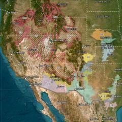
Rangeland Brush Estimation Tool (RaBET)
The Rangeland Brush Estimation Tool (RaBET) is an interactive, map-based tool developed to support ranchers, other land managers, and conservationists in estimating woody plant canopy cover and assessing woody encroachment on western rangelands. Data are available from 2000 through 2021 for 15 Major Land Resource Areas (MLRAs) that extend from Arizona to Texas and north into Colorado and Nebraska.
RaBET provides a quantifiable method to track progress in removing specific woody species – including eastern red cedar, juniper, pinyon pine, mesquite, and creosote bush – from pastures, ranches, and other areas of interest. This tool functions as a calculated model that uses imagery to estimate woody plant canopy cover values by 30-meter pixel. Interactive features of RaBET allow the user to create or upload polygons of focal areas and to customize woody canopy cover classes. Users may also download summary graphics of analyses to assess woody cover change over space and time.
Specifically, RaBET may be used to:
- Determine woody canopy cover amounts,
- Observe the change in woody cover over time,
- Identify and strategize on focal areas in need of treatment, and
- Track effectiveness of the NRCS Brush Management (Code 314) conservation practice standard.
RaBET currently uses Landsat 5, 7, and 8 satellite imagery. As the tool evolves, Landsat 9 imagery will be integrated along with eight additional MLRAs.
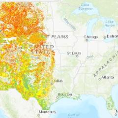
Rangeland Soil Vulnerability Index for Water Erosion Web Tool
The Rangeland Soil Vulnerability Index for Water Erosion Web Tool (rSVI-Water Web Tool) is an interactive, map-based tool developed by CEAP Grazing Lands to support rangeland conservation. This tool may be used by ranchers, other land managers, conservation partners, and researchers to assess the relative risk of water erosion for specific rangeland locations under dry, unvegetated soil conditions.
The rSVI-Water Web Tool provides map-based displays for rangeland in four geographic locations—the contiguous United States, Alaska, Hawaii, and Puerto Rico. The rSVI-Water Web Tool user guide covers all geographic areas of focus and provides the user information on the scientific background and data layers included in the tool as well as the matrix of soil properties used to rate soil components with a soil erosion risk class.
Users may leverage this tool to identify rangeland areas that are susceptible to water erosion and implement proactive conservation actions before potential issues – such as rangeland health, soil stability, water infiltration, plant productivity, and invasive species – become problematic. The rSVI-Water Web Tool may also help assess if current erosion control practices are successfully targeting areas of concern.
Soil Survey Geographic Database Query Tool (SSURGO-QT)
The Soil Survey Geographic Database Query Tool (SSURGO-QT) is an interactive, map-based tool developed to support land managers, conservationists, soil scientists, and ecological site specialists in quickly determining where soils with specific physical and chemical properties occur. SSURGO-QT enables users to select desired physical and chemical soil properties within an ecological region of interest. Users may query specific soil properties or characteristics at the soil mapping scale or within a self-identified area. SSURGO-QT is built using the Natural Resources Conservation Service (NRCS) SSURGO and 30-meter gSSURGO datasets.
SSURGO-QT includes the most pertinent soil characteristics that influence vegetation and water dynamics for vegetation and livestock management, cropping or yield limitations, and ecological modeling for any land use, among other focuses. Users may select from one or more of the 155 specific soil physical, chemical, hydrological, and climate regime characteristics for all soils mapped by NRCS to populate the map and understand how soils in a given area may affect unique conservation or land management objectives
Vegetation GIS Data System
The Vegetation GIS Data System (VGS) provides a suite of software applications that allow users to record, manage, analyze, and report on natural resources data across multiple land types including rangeland, cropland, and forests. VGS was developed by the University of Arizona in partnership with USDA’s Forest Service and NRCS, the Bureau of Land Management, the National Park Service, and the Public Lands Council.
Users including field data collectors, data managers, and researchers may use VGS to collect and assess a range of vegetation-related metrics, including those affecting rangeland health and pasture conditions. VGS manages both qualitative and quantitative inputs, photos, geocoordinates, and support documents and performs background calculations to instantly display results. This resource leverages the entire NRCS Plants Database, and users may create their own unique species lists for locations of interest across the United States. VGS includes pre-loaded standard field protocols supported by NRCS, USDA’s Agricultural Research Service and U.S. Forest Service, and others.
Visit the VGS website to learn more and directly access this resource with supporting materials.
CEAP Grazing Land Highlights
The below highlights represent recent resources and key findings released by CEAP on grazing land conservation efforts and outcomes. Visit this webpage frequently to see what's new, or browse the above publications to access a range of published resources from CEAP grazing land assessments.
Soil Survey Geographic Database Query Tool (SSURGO-QT)
SSURGO-QT is an interactive, map-based tool supports land managers, conservationists, soil scientists, and ecological site specialists in quickly determining where soils with specific physical and chemical properties occur. This 3rd version is updated with FY23 soils data and new filter functions.

Accounting for the Value of Ecosystem Services of Western Range Conservation Practices
Learn new findings on the ecosystem services value of three key rangeland conservation practices in this Conservation Outcomes Webinar presented by Dr. Aaron Lien with the University of Arizona and Angela Fletcher with Earth Economics.
Ask the Expert: A Q&A on Resources to Support Grazing Land Conservation with Carrie-Ann Houdeshell
This Ask the Expert features Carrie-Ann Houdeshell, CEAP Grazing Land Assessments Co-Lead. Carrie-Ann shares findings on three key grazing land conservation practices, new resources to assist data-driven conservation decision making, and NRCS programs and services for voluntary conservation.
Rangeland Brush Estimation Tool (RaBET)
RaBET is an interactive, map-based tool developed by CEAP Grazing Lands to support rangeland conservation. This tool may be used by ranchers and other land managers to estimate woody plant canopy cover and assess woody encroachment on western rangelands.
Rangeland Soil Vulnerability Index for Water Erosion Web Tool (rSVI-Water Web Tool)
The rSVI-Water Web Tool is an interactive, map-based tool developed by CEAP Grazing Lands to support rangeland conservation. This tool may be used by ranchers and other land managers to assess the relative risk of water erosion for specific rangeland locations under dry, unvegetated soil conditions.
Additional Resources
Conservation Effects Assessment Project (CEAP)
USDA’s Conservation Effects Assessment Project (CEAP) is a multi-agency effort led by the Natural Resources Conservation Service (NRCS) to quantify the effects of conservation practices across the nation’s working lands.
Learn MoreFrequently Asked Questions | Conservation Effects Assessment Project
This webpage provides answers to frequently asked questions about the Conservation Effects Assessment Project (CEAP).
Last Updated: June 9, 2023
Learn MorePublications | Conservation Effects Assessment Project
USDA’s Conservation Effects Assessment Project, CEAP, provides a suite of publications highlighting the effects of voluntary conservation across the nation’s working lands.
Learn MoreConservation Assessment and Planning Tools
USDA’s Conservation Effects Assessment Project (CEAP) collaborates with partners to deliver tools that support conservation assessment and planning for diverse land uses and management goals.
Learn More